We welcome as members individuals and organisations who care for Hammersmith

As a Member, you will receive regular updates outlining our activities, giving you the opportunity to participate in consultations and campaigns. We'll invite you to our Awards Evening and AGM, and other events. Members are always encouraged to take an active part in the work done by the committee – come along and see if you can help.
The membership year runs from 1st Jan, and only costs £6 for individuals, £8 for couples or families, and £15 for organisations. Additional voluntary donations always welcome.
- Published: 12 Jun 2023

RMH Block A – May 2023 proposal
Ideas for the development of the Ravenscourt Park Hospital campus are beginning to emerge from the new owners Telereal Trillium with their architects SPPARC Studio. There’s an interesting ‘information pack’ with historic photos and maps on their project website; here we include the key views from the May 2023 exhibition boards.
We’ve also seen detailed comments from the two adjoining Residents Associations – Ravenscourt Gardens and Ravenscourt Square – who both have significant concerns about adjacency and the effect of access requirements for a substantial housing development on their doorsteps. These have been submitted to the council, and while noting them, here we look more at the effect the proposals would have on the Grade II* listed building and its setting.
As proposed, the development would harm the buildings it’s supposed to improve.
The scheme proposes that the 1930’s hospital buildings would be enlarged by adding two, three or four upper floors, generally set back from the building edge, and faced with saw-tooth profile glazed curtain wall shown in the CGI’s above. The roof extensions would be limited to one level on the outer blocks of the principal building “Block A” facing Ravenscourt Park, which would be refurbished and converted for a community use yet to be defined; the remaining buildings would be refurbished and converted to residential use. We would welcome an open and inclusive process of co-design to evaluate possible future uses of Block A, to arrive at a defined and sustainable use that works for the community and developer.
The 1978 surgical and ancillary building on the northwest corner, beside Ravenscourt Square, is proposed to to be replaced by a residential block and a separate care-home block, shown as undefined white blocks “E” and “F” in the model above.
The hospital building is a stand-alone architectural whole, a form which does not readily invite extension. It employs a restrained, consistent architectural language, with regular geometric brick forms, orderly window perforations, playful articulation separating the building elements with circular balconies and pavilions, and a bold, heroic principal block facing the park. These unique qualities would be overwhelmed by the changes proposed. The roof extensions would impose an architectural levelling-up, bringing an inappropriate sameness to the distinctly separate elements of the buildings. The eye-catching angular glazing design would be at odds with the quiet regularity of the buildings below, and would hardly reflect the visual subservience required in planning policy.

RMH Blocks E & F as proposed May 2023
The new buildings proposed for the northwest corner “E” & “F” are shown only in diagram form on the display board image adjacent, and further design information is needed, including contextual views showing the relationship of the new blocks to the hospital buildings, the overall campus, and the neighbouring buildings of Ravenscourt Square – especially Grade ll No. 11, and locally listed No. 17 on the corner.
There is also proposed access East-West through the site, between blocks “D” and “E”, which is not currently possible, and it’s fair the say that there are mixed views about this proposed feature in the adjoining communities.
The NPPF (National Planning Policy Framework) sets out the relevant policies for listed buildings, and requires that alterations proposed to heritage assets are assessed by Historic England according to the extent of harm they would cause, and states that ‘…substantial harm to a grade ll* listed building should be wholly exceptional’ (NPPF para 200). Some concessions may be allowed where the changes would support the future conservation of the building, or would bring about significant public benefit.
These criteria rule out the current proposals: the extensions would bring very substantial harm to this wonderful building. While they could generate funds for the conservation of the building and gardens, the accommodation they provide would bring no benefit to the public.
Conclusion
The early opportunity for public involvement is welcome, and we have carefully reviewed the May 2023 proposals, and set out our response above, together with a letter containing the same points to the council planners.
Continued
- Published: 24 May 2023

The Origin and Possible Future of Hammersmith & West London College by Hans Haenlein
Click on the image to open the pdf ![]()
Under the banner ‘Taking a View’, from time to time, we’re pleased to publish articles by members on a subject of their choice, which they believe will be interesting to the wider membership.
In this article, our president, Professor Hans Haenlein, updates us on an issue close to his heart: Hammersmith & West London College, both from an architectural but as importantly, a topical Further Education point of view, tracing its origins back to the Arts & Crafts movement and William Morris.
If you have an article you would like to be considered, please contact .
Articles are unedited personal viewpoints, and may not always represent the views of the Society
- Published: 30 Mar 2023
In the last week there have been well-publicised consultation meetings either side of the river, covering the repair and refurbishment of the bridge together with proposed Foster/COWI temporary bridge. Below are photos of the models of the proposals, but there’s one further public exhibition in Barnes this Saturday – details in the diary
We’re delighted to see that the designers have adopted our 2020 proposal to widen the pathways alongside the bridge to at least 2.3m, to better facilitate walking and cycling which are currently rather less than ideal. One of the photos below shows before & after views, and you can see that the visual impact is minimal [click on the images for larger versions]. We understand that Historic England are satisfied that this won’t harm the setting of the Grade 2* bridge.


There’s a further piece of thinking to complete the necessary crossing of both 2-way cycling and pedestrians. Crossings naturally exist under the bridge at each side as we recall from the heights of COVID, but there remains a risk of paths crossing awkwardly. Subject to agreements, there may be an opportunity for the temporary walkway pictured to be part-repurposed into better crossover(s) after completion, with perhaps a smaller scale nod to the recent Dukes Meadows Footbridge.
Continued
- Published: 13 Feb 2023


In recent months we, our members, affiliates and others have noticed an increase in unsympathetic shop fronts or public realm land-grabs adjacent to shops, particularly in King Street, but elsewhere in the borough too. We are of course aware of the plight of the high street, an issue we wrote about in 2019, but the pandemic seems to have accelerated a slip in standards. The pictures also demonstrate an unfortunate correlation between these slippages, metal roller shutters (with or without graffiti), and some of the better historic buildings, sharpening the discordancy. Shopfronts require the same constraints as rear extensions – ‘subservient to the existing building’. A strong building presence at ground level – with visible walls between the shop openings – can accommodate a variety of shopfront designs without losing the integrity of the building design.
Some larger chains are showing is that it’s quite possible to build new frontages sympathetically, while maintaining enough corporate branding to meet the business needs, though it’s unclear how much cajoling the various local authorities undertook to achieve these results. Unfortunately we’re not seeing quite enough of this in parts of Hammersmith – yet.


Paintbox Studios and Coffeeology: Nancye Goulden Award 2019
Longstanding members will recall the Nancye Goulden award we gave to the Nicholas Mee showroom in 2013, a “stylish minimalist modern frontage”, which appeared to be a high point, with the nearby Ginger Pig also awarded in the same year. In 2019, helping to highlight what can be done in our high streets, we awarded the two adjacent shops shown at the western end of King Street, but the eastern end remains a rather different matter.

Nancye Goulden Award 2013 – The Ginger Pig

Nancye Goulden Award 2013 – Nicholas Mee Aston Martin showroom
A few years after the award, Nicholas Mee sold up, possibly feeling – correctly as it turned out – the zeitgeist turning significantly against car ownership in general, big-engined luxury car ownership in particular, notwithstanding the skilled jobs involved. The workshop in Wellesley Avenue was also sold, leaving a site that’s been fought over tooth-and-nail since. These days, the mere suggestion of a car-related enterprise locally may have segments of the population foaming at the mouth, though the residents of Wellesley Avenue probably still reflect fondly on the glamorous metal formerly adorning their neighbourhood. We digress.
Continued
- Published: 15 Nov 2022

RMH isometric from https://www.ravenscourtparkhospital.info
Earlier this month we met with the new owners of RMH, Telereal Trillium, their planning consultants, Turley, and Trevor Morriss of SSPARC architects appointed for the redevelopment, who you may remember giving a presentation on the Olympia redevelopment at our AGM in 2019.
They gave us a rundown of Telereal Trillium’s background (mainly a large portfolio of former public sector property, a large proportion of which were in the BT and DWP estates, formerly owned by Land Securities). This is not their first listed building redevelopment – the example they gave us was the one on the website, the Grade II listed Tooting Police Station. As it’s early days, there were no more details available other than that on the website boards, shown above and on their website.
Telereal Trillium describe themselves as an £8 billion family owned property development company owned by the William Pears Group. They say that they are not “operators”, they have moved from being owners to owner/developers recently, and are not currently planning on going further into running buildings.

RMH block plan view
The 80’s block at the back of the site shown in pink adjacent, “Block E”, was suggested as the location for the main redevelopment activities, the rest of the estate is more a case of preserve, enhance and convert into luxury accommodation, with restoration of the surrounding gardens, which is good news.
Discussions with the council started in June, but there have been no formal planning pre-application meetings yet. We mentioned that we’re extremely keen to engage early, offering our experience and local knowledge on behalf of the wider community. Meanwhile we’re looking at how National (NPPF), London-wide (London Plan), and borough (Local plan) guidance applies to this project.
The large public spaces in the listed parts of the estate (“Block A”) are where the community use and engagement is critically important. We discussed possible educational and other uses, but only in outline at this initial stage.
We’re pleased that this important building has an engaged new owner, and look forward to its unique interiors being open for public enjoyment again in an appropriate form. Your suggestions for suitable uses are most welcome.
- Published: 15 Nov 2022
New Civil Engineer recently reported that the bridge stabilisation has progressed and that specialist concrete has been poured into the cast iron pedestals to prevent them collapsing. This means that the bridge is safer for the next stage of repair, which we mentioned in the last email. The stabilisation works are scheduled to complete by the end of February 2023.
It’s worth mentioning again that while the funding arrangement for the rebuilding has been determined, actual funds remain scarce, and the long term funding and maintenance model is undecided. The council prefers to package it up so it can be put into a trust and managed at arms length.
The next step is diversion of a gas main at a cost of £5m, and the letting of contracts so that works on the actual major repairs can begin. We have requested copy of the £200k feasibility report into the Foster/COWI temporary bridge to better understand details of the proposals.
There’s been some press and politics around a proposed bridge toll as a way to close the gap in funding for the rebuild, and whether or not residents would be expected to pay. A historic problem with tolls has been that it cost a significant percentage of the actual toll to collect, and with so much cash sloshing around, there was often significant fraud. Newer technology, such as Automatic Number Plate Recognition (ANPR) would presumably lessen these overheads, if not the displeasure.
We are grateful to the Barnes Bugle for alerting us to a detailed video from Mott’s explaining the whole process for those interested in the technicalities:
Continued
- Published: 26 Oct 2022

King Street – M&S proposed frontage elevation
Many of you will have been to the exhibition at the Lyric recently to view the proposals and displays. We exhorted the development team to show full elevations, but the best we achieved at the time were partial CGI images. They have now come forward with North and East elevations, which are on the consultation website, along with the exhibition boards, and above / below, and appear to be part of a pending planning application. The large towers in the background are the proposed Landmark House, as yet unbuilt, and we believe subject to change of ownership, and therefore possibly design change too.
As you can see, our very approximate CGI in the earlier article was reasonably accurate dimensionally, if not aesthetically, and at 47m, this undistinguished proposal is of alien scale, substantially higher than the Lyric, and a large intrusion on the King St. horizon. The 15m setback from the street helps reduce this intrusion only marginally, which you can see below.

King Street – M&S elevation, East
More importantly, acceptance at this dimension would set a bulk and height precedent along King St., much as we’ve recently seen used in the 66 Hammersmith Road proposal, especially in the continuing absence of an issued Town Centre Masterplan, or planning brief, a subject on which we repeatedly remind the council is nearly 5 years overdue. We haven’t even mentioned a likely West-East prevailing wind tunnel, increased if others were to follow suit.
Continued
- Published: 26 Oct 2022

Black Bull Tavern 122a Holborn, 1901 [pubwiki.co.uk]
The Black Bull was modelled in the early 19th century by Obadiah Pulham from Pulham & Son. In Victorian times, this was a well-known Suffolk-based firm specialising in the production of garden ornamentation for prestigious sites across the country and the material used would have been ‘Pulhamite”, a particular blend of artificial stone they had devised.
Brought into London by Thames barge, the bull’s destination was to serve as the sign for the Black Bull coaching inn at 122a Holborn, an establishment mentioned by Dickens in Martin Chuzzlewit. He adorned the front of that building until 1904 (seen below the second floor window alongside the Black Bull nameplate), when the old inn was demolished to make way for a corner extension to the original Gamages department store.

Black Bull transitioning to Gamages, 1904, [pubwiki.co.uk]
Reporting this event with some regret as the loss of a favourite destination for American tourists, the New York Times wrote on May 20, 1904: … “the old Black Bull of Holborn was lowered from his perch yesterday, and his retirement from public life marked the demolition of the famous old London inn that bore his name”.

Sir William Bull MP’s offices at 269 King St, bull over entrance [H&F Archives]
But saved from destruction by the Hammersmith MP Sir William Bull, our bull was transported over to King Street and relocated above the entrance of the Georgian terraced offices of the MP’s law firm, then at number 269. There he stood for over half a century until those buildings too were demolished.
Rescued again, he was brought down to earth to be unsuitably positioned head-on, on a plinth in the forecourt of an undistinguished ‘estate-style’ pub called the Ravenscourt Arms, later renamed the Black Bull, built in 1966 on the site next to Vencourt House, now a Premier Inn, at 257 King Street. In recent years, that pub too closed, leaving the Black Bull of Holborn stranded in the tumbleweed, and once more seeking a suitable Hammersmith home.
The Ravenscourt Arms was owned by Charrington, its successor the Black Bull was part of Punch Taverns, but according to the council, current ownership looks to be connected to the hotel adjacent. Do you know any more? We, alongside Heritage of London Trust, would like to have him restored, and found a more appropriate home.

The Black Bull in King St. 2022
- Published: 27 Sep 2022

66 Hammersmith Road – Big Yellow – 2022 proposal
We wrote about this site nearly five years ago, and in summary, our view then was that it was rather overbearing on the listed buildings opposite, and adjacent conservation areas. Since then, Olympia has come along and given us a whole new perspective on large redevelopments in the vicinity. You can see a CGI of their (under construction) theatre block in the foreground.

66 Hammersmith Road – earlier 2017 proposal
The 2017 plans will lapse in November, and though not being pursued, importantly were consented under 2017/04752/FUL a full two years after being lodged. This means that it’s (legally) significantly harder to roll back from such a substantial scale, and goes a long way to explaining why the new proposal bears more than a passing resemblance to the earlier one.
As an aside, we’d urge the planners and developers to spend a little more time meaningfully consulting earlier in the process with LBHF setting a high bar when considering such substantive impacts on the townscape. Hammersmith Road, like the Town Centre, needs a planning brief so that buildings are not proposed willy-nilly without context. There are several 1980’s blocks along the road where Cadby Hall once stood, and unless forethought is applied, a mish-mash of undistinguished buildings may soon be proposed – notwithstanding the present object – to replace the existing ageing and undistinguished mish-mash. Despite boilerplate sustainability statements, such substantial concrete-and-steel proposals are unlikely to feature as highlights on the council’s Climate Emergency agenda, or tick the boxes of the Architects’ Journal RetroFirst campaign, already in its fourth year. We’re again being “consulted” moments before the public, which begins to look like consultation lip-service, and means that in effect little change can be made.
Architecturally, the expressed external structure introduces an inappropriate visual complexity which at the same time creates a perception of additional bulk at roof level, with an unnecessarily prominent parapet in the sky silhouette.
Close by in the next block is the Grade 2 listed façade of Olympia, soon to be joined by dominant neighbours – the jazzy new theatre on the Olympia west side shown above, and the rooftop hotel on the east side. The busyness of the proposed façade of No. 66 would add to this discord. CGI images from a viewpoint west of No. 66, and incorporating Olympia G theatre and the retained Olympia façade, would be an instructive exercise in considering the contribution the proposals would bring to the setting of the listed building.
Some good news!
The proposed building is set back a little more than the 2017 version shown, and is not significantly larger. It’s not painted bright yellow, but the developers might like to consider just how far a little red goes. The public realm is better served by the slightly improved landscaping, and the detailing of the building is better. Access via Blyth Road is a little better than as currently via the end of Lyons Walk, which allows the latter to be better landscaped (by LDA design), and coordinated with Olympia adjacent.
There is some community space, which, given the Lyons and LEO heritage, might best serve as a computer club or similar technology education facility, suitably themed, perhaps involving an association with local schools such as Avonmore primary? The location around the LEO plaque itself is planned to be improved, or the plaque better sited – we’re in contact with the LEO Computers Society who are also being consulted.
We requested the developers look at the space around the bus stop adjacent, the pavement around which is currently very cramped, though changes in the cycle lane alongside, post-Olympia, may change all this.
A public consultation exhibition is being held on 5th October – details are in the diary – and there’s a consultation website with a few more images and details. Let us know what you think.
Continued
- Published: 23 Aug 2022

M&S Hammersmith King Street – historic image – 50’s/60’s
You may have seen the website https://27kingstreet.co.uk recently created for a consultation related to the proposed redevelopment of Marks and Spencer in Hammersmith. Like many high street shops, this location has become a little tired in the nearly 100 years of its existence, and our M&S has additionally had a curiously broken roofline for as long as anyone can remember, caused we’re told by partial demolition and the machinations of former planning constraints. The above historic photo shows it as it was before its front teeth fell out.

M&S visualisation 27 King St
Fresh from a dressing-down over the proposed Oxford Street redevelopment with Pilbrow & partners, M&S have unsurprisingly chosen a different group to work with here – Reef Group – and with rather different intents. We were provided a fuller picture of the plans for a welcome refurb at a presentation meeting with the developer and M&S in the first week of July.
The plan, though only mentioned in passing on the above website, is a complete rebuilding of the site to create 400 student rooms in a substantial 10 storey block above the store, thereby we assume funding its redevelopment, which like Chiswick’s, would become a larger, but food-only affair of 15000 sq. ft (currently 6000), and based on a market hall concept developed in Clapham. The façade would be retained, the existing gaps filled sympathetically, and the 10 storey block would sit behind and above the façade. This would considerably improve the food offering, but other offers, such as clothing, would become click-and-collect only.

M&S visualisation with the proposed Landmark House some way behind (22 storeys). The proposal is 10 storeys + podium.
Unfortunately the website visualisation provided (reproduced above) is at such an extreme angle as to mostly hide this substantial building, which is higher than the Broadway buildings, and about the same as the striped glass-clad office building next to the Hammersmith & City Line station, known officially as ’10 Hammersmith Grove’.
We were provided with the adjacent visualisation, still at a rather unsatisfactory angle, and over the long hot weeks since, we’ve been pondering the developer’s coyness at showing the scale of the student blocks, and their effect on the streetscape, light and the Lyric. We’ve asked for ‘Verified Views’ or ‘Accurate Visual Representations’ (AVR) more than once now.
With time passing and the requested visualisations unavailable, we had little option but to use the above information to project our own approximation overlaid onto a Google Earth 3D view of King Street, which is shown below. It uses the above visualisation to project the view at an appropriate angle, showing the approximate scale of the proposal.
With the Lyric on the North side, predominant light from East, West and importantly the South, is not blocked. By contrast, this proposal would cast a substantial shadow over the street, Lyric and particularly Lyric Square, significantly reducing it’s appeal.

Marks and Spencer proposed redevelopment – approximate 3D overlay onto ‘Google Earth’
Continued
News Topics
Our Diary
-
Committee meeting
📆 Mon 13th Jul | 18:00 - 20:00
-
Community Day
📆 Sat 18th Jul | 11:00 - 17:00
🚩 Ravenscourt Park (map)We're taking a stand - come along and say hello
-
Committee meeting
📆 Mon 14th Sep | 18:00 - 20:00
Recent News


Local and Affiliate News
One news item from each selected source – more on our Local and Affiliate news page. Subscribe to our weekly highlights
- Health & Wellbeing Board: Monday, 22nd June, 2026 6.30 pm Read more »
 Orders can now be accepted up until 2am on some evenings Read more »
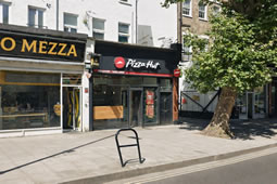
 A resident living by the King Street Pizza Hut said he feared the later hours "would give rise to complaints" Read more »
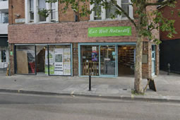 Eat Well Naturally did manage to extend licence until 2am Read more »
 A Policy Paper has been published on this subject. The Government wants to reduce delays in the delivery of nationally important infrastructure,… Read more »
- The Conservatives have consolidated their control of Hillingdon Council with a decisive double victory in the two-seat Hillingdon West ward, a contest… Read more »
 Hammersmith and Fulham Council's existing PSPO already covers parts of Shepherd's Bush and White City Read more »
- We will again be at Hartswood Tennis Club in Hartswood Gardens for our AGM and Social on Wednesday 8 July at 7pm.… Read more »
- Cabinet: Monday, 15th June, 2026 7.00 pm Read more »
 Last week the Soho Society, a civic society “for all the people that have Soho in their lives” voted at its AGM… Read more »
- Looking for the best pubs in Hammersmith to watch the World Cup 2026? We’ve put together a guide to the top Hammersmith… Read more »
 Selma van de Perre The Ravensbrück Rose Rosa ‘Résurrection’ Ò (Krylexis) In June 2026, Ravensbrück roses have been planted in St Peter’s… Read more »
 We are delighted that land in Cornwall has been registered as common. Planning inspector Daniel Young has granted the society’s application to… Read more »

Most Popular Articles This Week


 ©2026, The Hammersmith Society | Privacy | Contact | Join | @ Subscribe | ⓘ
Campaigning for over sixty years