We welcome as members individuals and organisations who care for Hammersmith

As a Member, you will receive regular updates outlining our activities, giving you the opportunity to participate in consultations and campaigns. We'll invite you to our Awards Evening and AGM, and other events. Members are always encouraged to take an active part in the work done by the committee – come along and see if you can help.
The membership year runs from 1st Jan, and only costs £6 for individuals, £8 for couples or families, and £15 for organisations. Additional voluntary donations always welcome.
- Published: 03 Sep 2024
Nancye Goulden Award, 2024.
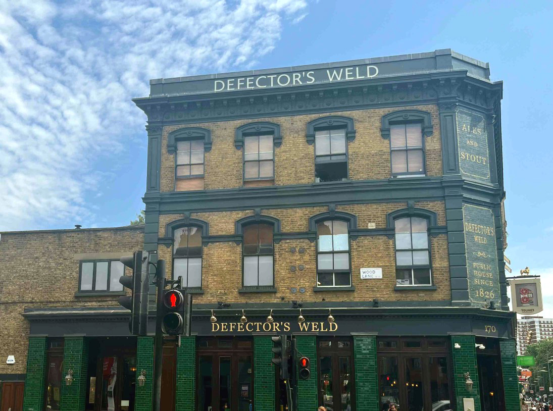
The elevations of this Shepherds Bush Green landmark have been renovated in a sensitive and attractive manner that contributes to the street scene. Furthermore, the rear extension and remodelling has created an interesting semi-external space to the rear. The newly tiled façades should be effective in maintaining the appearance of the building in future years.
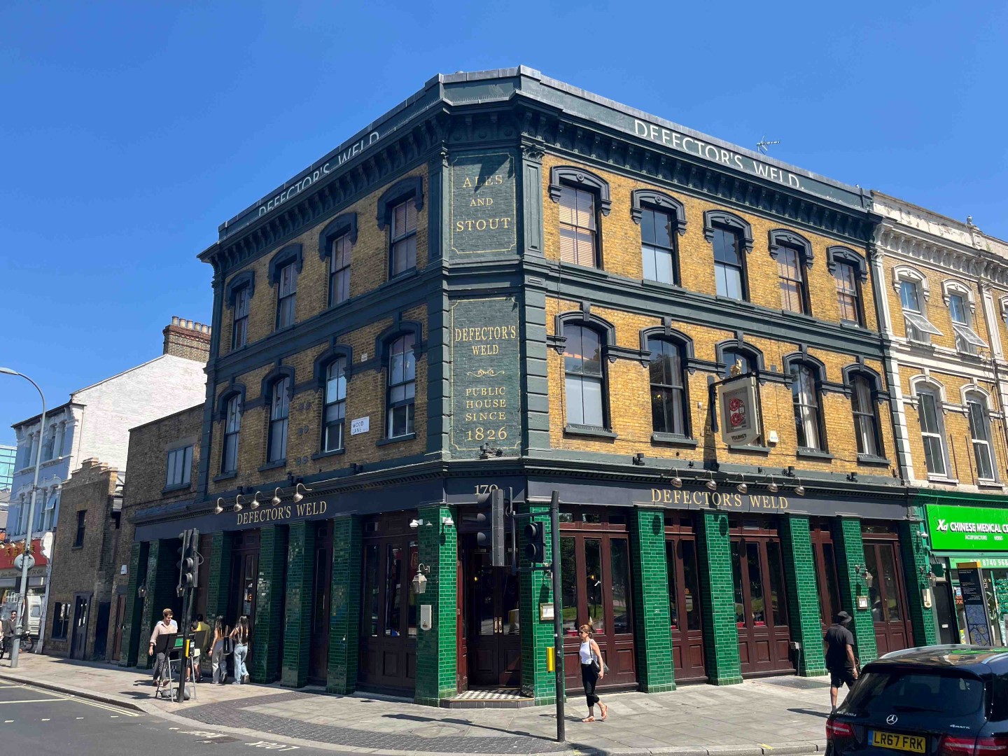
The Defectors Weld 2024
The Defectors Weld 2024
- Published: 02 Sep 2024
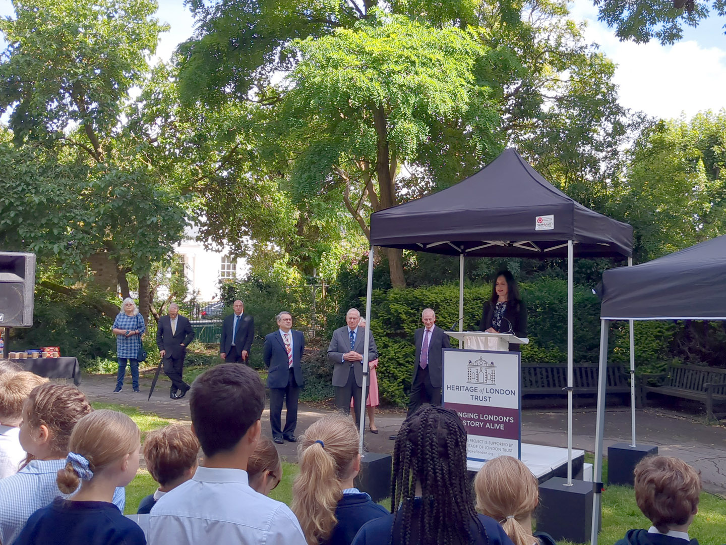
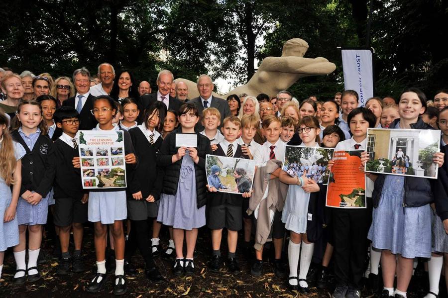
Tom Ryland Award for Conservation, 2024.
The Leaning Lady was restored this summer, after more than sixty years. Along with other artworks, the statue was a gift to the community from the LCC partly as reparation for the damage caused by the building of the Great West Road through the middle of Hammersmith in the 1950’s. The statue was created by Czech refugee Dr. Karel Vogel in an unusual concrete material that had eroded over time. The restoration project was driven by affiliate SPRA and the council, and managed by Heritage of London Trust who also part funded the project with many local people in a community-driven fundraiser.

Leaning Lady restored 2024
Dr Nicola Stacey of Heritage of London Trust at the unveiling of the restored Leaning Lady Statue with HRH Duke of Gloucester
Leaning Lady unveiling “Proud Places”

Tom Ryland Award for Conservation 2024 – with affiliate S.P.R.A. and Heritage of London Trust [Photo: HOLT]
Visit the above links for the charming story of the unveiling by HRH the Duke of Gloucester, in the presence of many local schoolchildren who created their own projects around the restoration, as part of HOLT’s Proud Places programme.
- Published: 27 Aug 2024
Wooden Spoon, 2024
For the second time in their short history, the Livat planters have been nominated by a member. They were nominated for their effort in cheering up King Street and Ashcroft Square when they appeared in 2022, but on reflection, the committee decided that they didn’t quite make the grade for an award. Since then, little maintenance appears to have been done in King Street, and they have become an unfortunate eyesore. As every council knows, plants, particularly those in relatively shallow planters need watering, care, and maintenance. That bit of the equation seems to have been missed, and instead they have become impromptu ashtrays for the adjacent ‘smoking benches’.

Livat planters 1
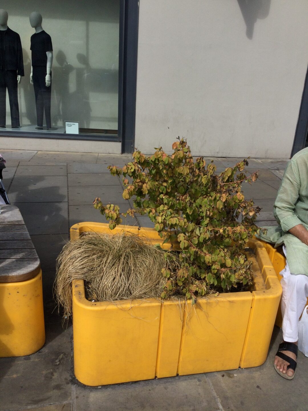
Livat planters 2

Livat ‘smoking bench’
However, upstairs in Ashcroft Square, things are looking up, with some new planting. Perhaps there’s been some guerrilla gardening? Enough to save the planters from the wooden spoon?

For comparison, this is a street scene near the back of Victoria station, showing how a little TLC and suitable arrangement of planters can transform a small area into an attractive ‘parklet’.

Victoria street scene
- Published: 24 Jul 2024
Wooden Spoon, 2024.
True? It certainly looks like it. First, the popular paddling pool acquired a costly gated cage, a pre-booking requirement taking much the spontaneity out of a summer visit, with numbers, time limits and families frequently turned away. Next, some gates – function unclear – have appeared across the busy Ravenscourt Avenue entrance. Ugly and unwelcoming, these gates not only obscure views into the Park but cause maximum inconvenience and frustration to park users who find themselves having to queue to get either in or out. The Friends of Ravenscourt Park were not consulted on either.

Ravenscourt Park – before
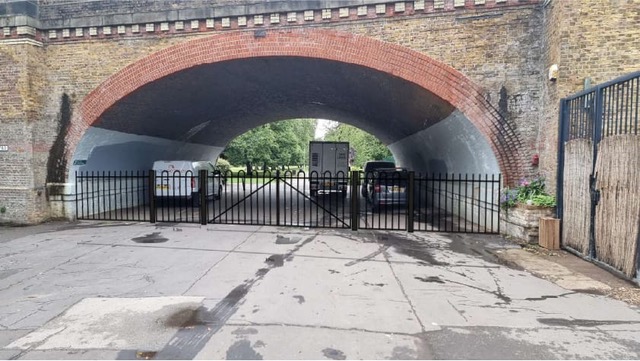
Ravenscourt Park – after
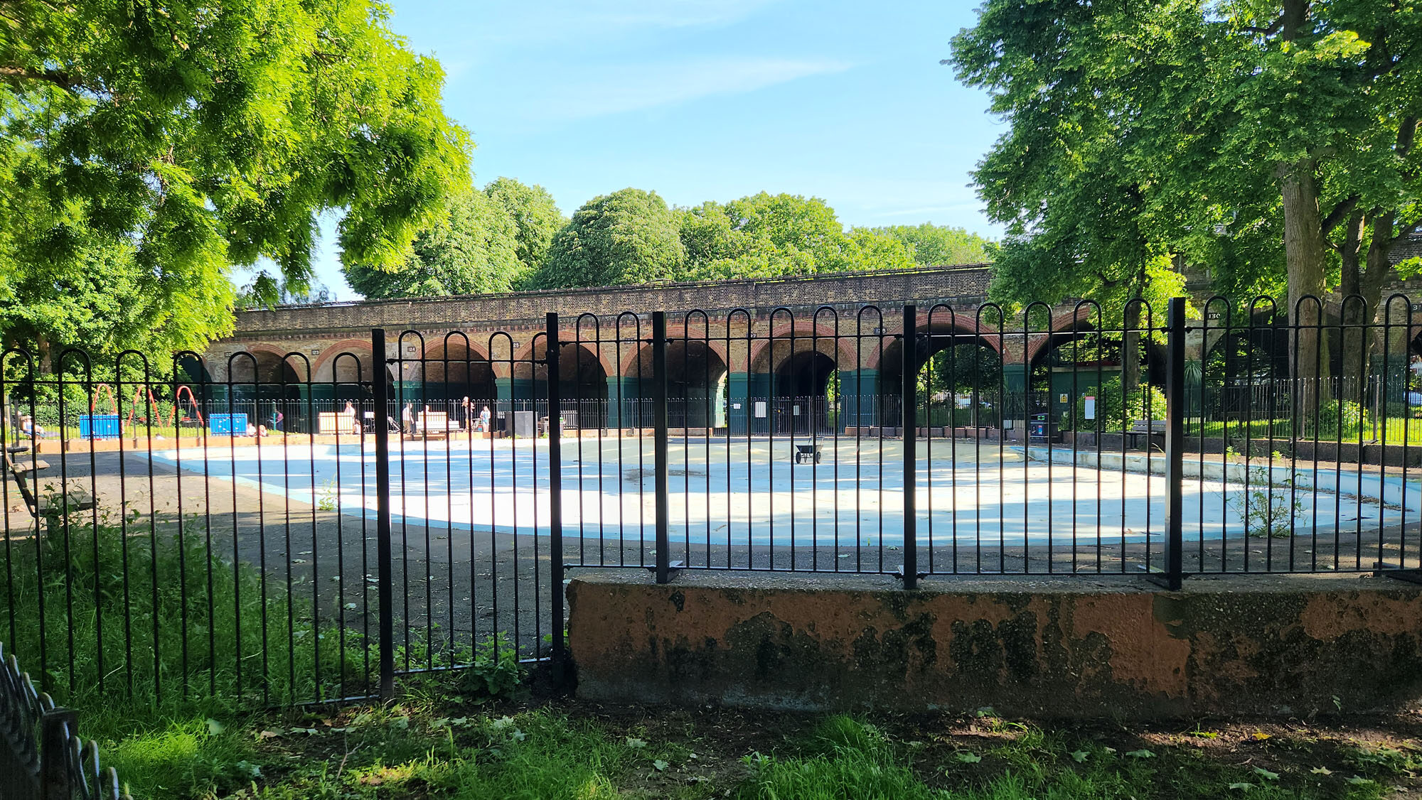
Ravenscourt Park Paddling Pool June 2024
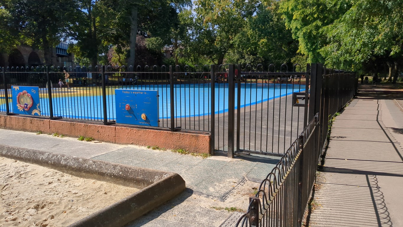
Ravenscourt Park Paddling Pool, August 2024
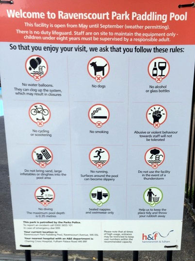
Paddlers beware
Posted in Award winners
Tagged Council Parks/Open Spaces Ravenscourt/Grove Society/Awards
- Published: 18 Jul 2024
Goldhawk Road would have been an attractive boulevard in its day: at the Shepherds Bush end, a wide street lined with terraced housing, shops at ground level, pubs on every corner, changing as you travel west, to the more sedate, semi-detached villas with front gardens – gardens which were later cut short to make way for a road widening which never took place. Over the years, development has eroded this street consistency but the distinctive scale and style remains.

190-194 Goldhawk Road
On the north side, near the Paddenswick Road roundabout, there are proposals for residential redevelopment on an unusual site at 190-194 Goldhawk Road, next to the 1930’s style Melville Court flats, a site with a wide frontage and stretching back some 140 metres to the Hammersmith Academy at the rear. The development proposals include a 6-storey block on Goldhawk Road, with 24 flats (50% affordable) and a ground floor commercial unit, and a 2-storey mews terrace of 12 houses at the rear.
Apart from the penthouse, the scale of the front block sits comfortably in its street setting, but the street frontage, with its dominant projecting balconies and pronounced banding, would bring a heavy, dominant presence, out of harmony with the street and belittling the more reticent balconied façade of Melville Court next door. The penthouse proposed for the roof of the block is wholly out of place, its height and its awkward projecting roof an alien feature in the Goldhawk Road streetscape.

190-194 Goldhawk Road Mews Houses
At ground level a gated access-way under the block leads to the mews housing behind, where you arrive in a more domestic, private world. This is an ingenious design, making the most of a difficult site, and creating an attractive backwater tucked away from the busy road. The layout is very compact, leading to one or two shortcomings which deserve further consideration: there appears to be no access to the houses for delivery/removal vehicles, and there is little outdoor recreation space for children or adults – and if there is to be reliance on proximity to public parks, a development contribution should be included towards parks maintenance; noise from comings and goings at the front of the houses is likely to disturb the private gardens of Cathnor Road very close by.
Continued
- Published: 18 Jul 2024

‘Snowdon Collection’ Trimphone – still with pulse dialling!
You’ve probably heard that the old copper phone lines will soon be switched off for good, after over a century of service. Since December 2023, you haven’t been able to buy a new land-line service from any company, the so-called “Stop Sell” date.
The exact switch-off dates have been moving around between the end of next year and January 2027, with variability in what Openreach (the wholesale supplier), and BT, Plusnet, Virgin Media etc (the retailers) say, which confuses the situation, but early 2027 appears the latest possible date. Beware that if you upgrade your broadband to “fibre” now, or terminate your phone service rather than switching to another provider, you’re on the slippery slope to no conventional land-line, you cannot get it back once lost – possibly including your number – at any price.
Here we look at what the options and opportunities are, and note how surprisingly environmentally unfriendly and limited the default BT offer turns out to be, when compared with other options, and especially when compared with existing and in terms of environmental impact, the old tech. Google has similarly discovered that its new AI tech caused a 40% rise in power consumption last year, with AI reckoned to be 100 to 1000 times as energy intensive as traditional server activities, but here the percentage increase can dwarf even that, recalling that the IT industry is currently as responsible for as many global CO2 emissions as air travel.
The change is happening globally – the US date was 2022, Canada 2023, and European countries have set various dates from 2021 to 2030. The Luddites amongst us will be forced to act shortly, in one way or another, and if “full fibre” needs to be installed, the front of your building will very likely need a new hole drilled in it, hence our interest.
Here’s what Ofcom say. What they don’t appear to say is that there are independent services, a range of magic boxes, and even virtual solutions to convert your land-line number to the new tech, so that if it’s of value, you can keep it, without physical upheaval, and even use it on a mobile, independently of your existing supplier or broadband contract – read on.
The lack of a land-line won’t worry many, with unlimited calls now the norm for mobile contracts, and the most frequent users of land-lines now possibly nuisance callers, but it may be of concern if :
- You only have a land-line and no broadband internet connection.
- You have a burglar alarm with a monitoring service (auto dialler etc).
- You have a telecare service (falls detector etc).
- You run a business with a number that people know, which is also doubtless widely published.
- You want a full-featured desk phone, or the reliability and convenience of multiple phones around the home, rather than using your mobile.
Continued
- Published: 28 Jun 2024

Wheelie Bins roll into Brackenbury
Click on the image to open the pdf ![]()
Under the banner ‘Taking a View’, from time to time, we’re pleased to publish articles by members on a subject of their choice, which they believe will be interesting to the wider membership.
Late last summer we wrote about Wheelie Bins, which seemed to touch a nerve amongst members and affiliates. It continues to be one of the most popular articles on our website nearly a year later, and now that the bins have arrived, its predictions appear more accurate than many an election claim, as More or Less may confirm.
In this follow-up, two longstanding members detail what’s happened in Brackenbury, with photos. The council might reasonably improve the situation for the large number of smaller properties in the borough by rightsizing the default offer, as described here.
If you have an article you would like to be considered, please contact .
Articles are unedited personal viewpoints, and may not always represent the views of the Society
- Published: 31 May 2024
Nomination for a Wooden Spoon, 2024
Planting at 181 Talgarth Road – the new Premier Inn and PBSA, still under construction
181 Talgarth Road border planting
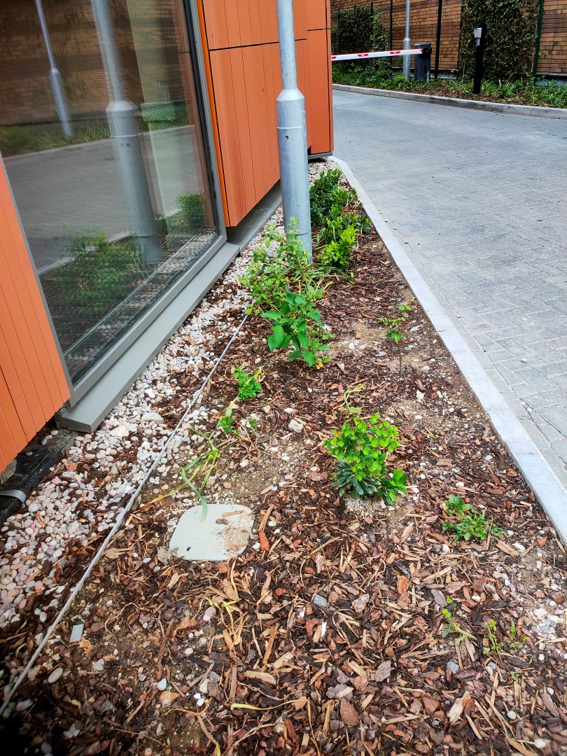
181 Talgarth Road Premier Inn planting
The small bed which is the first thing you see as you arrive at the Premier Inn from Hammersmith underground station is almost bare, and compares especially badly after the very good planting at The Ark next door.
The planters to mask the new building from the houses in Margravine Road are nearly dead and planted in what looks like builders rubble not compost, which makes it unsurprising that they won’t grow.
- Published: 12 May 2024
Nomination for a Tom Ryland Award for Conservation, 2024
The office of Beata Heuman

Beata Heuman, 188 Hammersmith Road – exterior

188 Hammersmith Road – exterior (night)
See Beata Heuman and House and Garden
Nominated by a member who says “There are often members of the public taking photos of this building, especially at night, as it is beautifully lit as well as sympathetically restored. It is a joy to walk by. The small “Wildlife” Garden is very well tended and is a great addition to having some plants and greenery to admire along this road”
- Published: 12 May 2024
Nomination for a Wooden Spoon, 2024
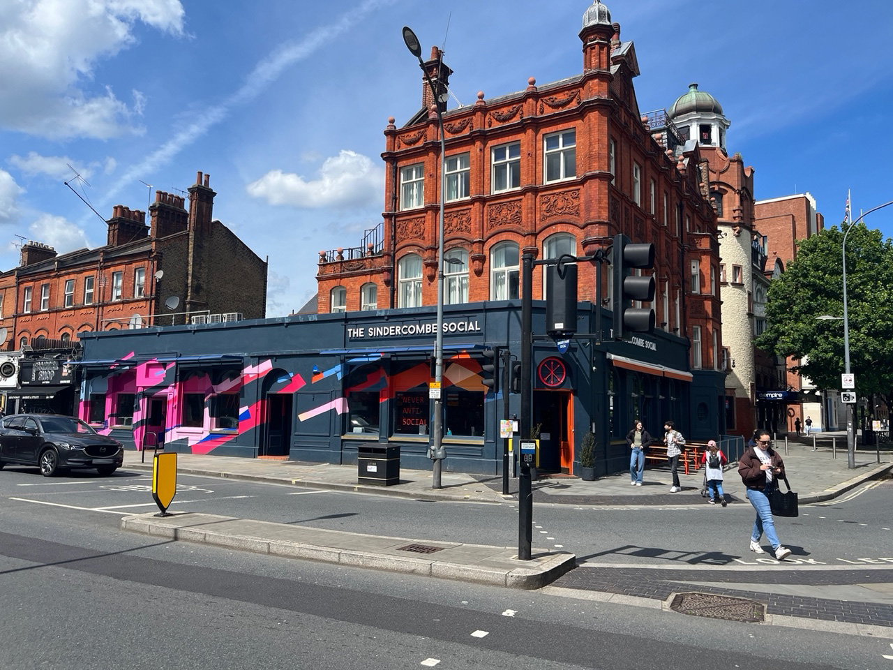
Sindercombe Social 2024
The Sindercombe Social has had an interesting makeover for 2024 with a Ziggy Stardust-inspired “youth club vibe”.
It’s rather a contrast to the work undertaken to The Defectors Weld to improve their façade on the opposite corner of the green, nominated for its improvements. Ziggy famously shocked his fans by falling to Earth with his ‘Spiders from Mars’ in the nearby Hammersmith Odeon, on 3rd July 1973.
News Topics
Our Diary
-
OPDC Community drop-in
📆 Tue 16th Jun | 15:00 - 19:00
🚩 Oaklands Social, Oaklands Rise, 2 Green St, Old Oak Common Lane, NW10 (map)Drop-in session to provide an overview of procurement for a private sector partner including approach and timescales and to share again the illustrative masterplan for Old Oak which a delivery partner will work with OPDC to deliver.
-
Committee meeting
📆 Mon 13th Jul | 18:00 - 20:00
-
Community Day
📆 Sat 18th Jul | 11:00 - 17:00
🚩 Ravenscourt Park (map)We're taking a stand - come along and say hello
 ©2026, The Hammersmith Society | Privacy | Contact | Join | @ Subscribe | ⓘ
Campaigning for over sixty years